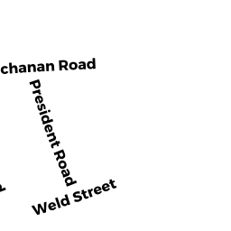
28 BUCHANAN RD
Owner Information
LEAHY RICHARD C TS
28 BUCHANAN RD
WEST ROXBURY, MA 02132


Property Details
28 BUCHANAN RD is classified as a Single Family Residential (Colonial).
The primary structure on this property was built in 1920. There is 1,768ft2 of residential/living space within this property. This property is listed as having 7 rooms.
28 BUCHANAN RD is valued at $561,400. The land is valued at $186,600 and the structures are valued at $374,800.
The most recent deed for 28 BUCHANAN RD is recorded at the local registrar in Book 25046, Page 148. 28 BUCHANAN RD was last sold on Thursday, June 15, 2000 for $9.
Assessment data from fiscal year 2020.
Flood Data
According to the FEMA National Flood Hazard Layer, this property does not appear to be in a flood zone. It may also be in an area not yet reviewed. Nonetheless, confirm this information prior to taking any action.
To view the flood hazards around this property, create a FEMA "Firmette" Map of the area around 28 BUCHANAN RD.
Broadband Internet Providers
| Provider | Type | Bandwidth (mbps) | |
|---|---|---|---|
| Verizon New England Inc. | Fiber | 940 | 880 |
| GCI Communication Corp. | Satellite | 0 | 0 |
| T-Mobile | Fixed Wireless | 25 | 3 |
| RCN | Cable | 500 | 20 |
| VSAT Systems, LLC. | Satellite | 2 | 1 |
| HughesNet | Satellite | 25 | 3 |
| Comcast | Cable | 1000 | 35 |
| Viasat Inc | Satellite | 100 | 3 |
Broadband service provider data from December 2020.
Adjacent Properties
- 32 BUCHANAN RD
Single Family Residential owned by STENSTROM ROBERT E - 24 BUCHANAN RD
Single Family Residential owned by REGINATO ANNEMARIE TS - 21 ANDOVER RD
Single Family Residential owned by REMICK ROBERT A TS - 1391 CENTRE ST
Single Family Residential owned by SPEED THOMAS M ETAL - 1397 CENTRE ST
Single Family Residential owned by MAHONEY KATHLEEN T